Map
Where are we?
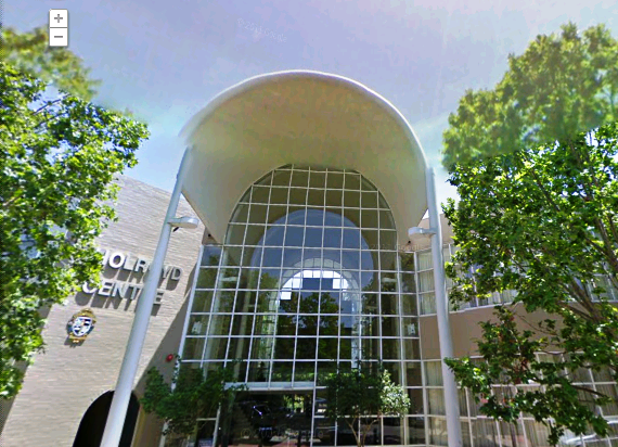
Here is the front view from Google Maps street view of the Holroyd Centre. Bright and sunny by day and romance blossoms in the evening with all the fairy lights in the trees that line the Holroyd Centre frontage.
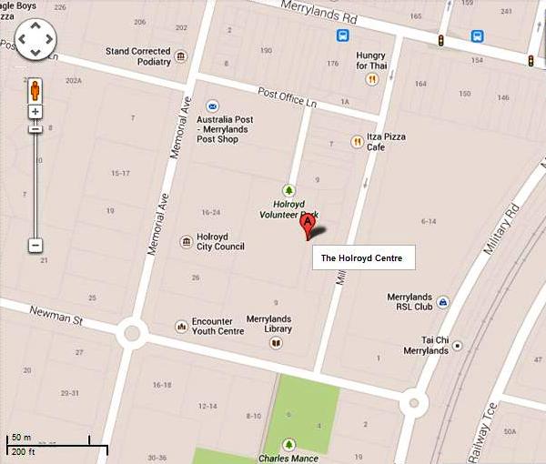
The Holroyd Centre as per the map below is located on Miller Street between Newman Street and Merrylands Road. We are conveniently located next door to Merrylands Library. Bus stops, taxi ramps and the Merrylands Train Station are all conveniently located within a 2-3 minute walk.
What is around the Holroyd Centre
Other business services such as Holroyd Council, Australia Post and Merrylands Police Station are located on Memorial Avenue behind the Holroyd Centre.
You will also enjoy Stockland Mall with plenty of opportunities to shop, experience or casually walk-around. The Roads and Maritime Service plus Centrelink are accessible from McFarlane Street, which will only take you a couple of minutes to walk across from Merrylands Road.
Recent Comments